Registered riders should have received Communique #2 today.
There’s a live link to sign up your SPOT tracker (mandatory) and the final route cues attached.
The fish is in the water!
Registered riders should have received Communique #2 today.
There’s a live link to sign up your SPOT tracker (mandatory) and the final route cues attached.
The fish is in the water!
The route is finalized & sittin’ pretty at 374 miles, 31k ft of climbing.

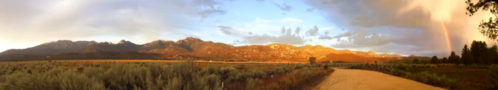
The biggest, most notable difference between the early rough draft and the final route… no Salton Sea. The route was too long with that section, and we’ve got a fantastic diversity of terrain even without it. The new, final route features the mountains, desert, and ocean we’d set out to highlight in the first place. Oh, and we’re sitting at 80%+ dirt. Not too shabby.
We are tabulating the final cues now. In the mean time, view the route here on the leaderboard. An email with the route GPX will be landing in your inbox shortly. We’ll discuss the route in greater detail in the next post with cues attached. Get to studying!
Posted in enduro info, Maps & Cue Sheets
We’ve all been waiting patiently for the rest of the cues and the GPS track so we can start planning out the details of the ride.
What’s taking so long?
We’ve changed up the route; essentially turning it from a counterclockwise loop to a clockwise loop. But that rabbit hole is a little deeper than that might sound.
How come it’ll be going the other way?
We want to offer up the best possible dirt touring route possible, with the best representation of our little slice of Southern California. Like one of those routes the Adventure Cycling Association has. In that vein, we will now get to ride Palm Canyon and later, Noble Canyon. Both are Southern California classics.
What are the practical differences?
The route is a bit harder, and a bit more mountain bike-y.
What had been climbs are now descents, and vice versa. The route will start with the “desert” section, which means at one point the route will take you from below sea level (Salton Sea) to nearly 4k ft on Pinyon Mountain, by way of some beautiful but sandy roads. (Fish Creek Wash in the Anza Borrego State Park) We will climb Oriflamme Canyon (the stuff of legend) into the Cuyamacas & Lagunas. The addition of these two singletracks and the reversal of Oriflamme & Fish Creek wash are the most significant changes your legs will notice.
Does this affect the mileage?
It might make the route a bit shorter, since we’ll descend from the San Jacintos further south.
So when will the route be set up and ready?
Soon. Promise! We’ve got 200 miles of the clockwise route mapped & cues’d, and need to get the reverse track set for the “first 117” you’ve already seen and some of the urban/San Diego Bay area. Hopefully the whole shebang will be done inside of two weeks.
We’ll be posting more info on the route, the cues, and SPOT registration here.
 A very early start list has been posted and it’s going to be an exciting ride with all the usual suspects! Check it out here. We will be updating it weekly and sending out notifications on the blog, for those that are subscribed. Enjoy!
We got these written over the weekend, and will continue to turn them out as quickly as possible. Ditto for the GPS track.
This first section takes us from the San Jacinto mountains out through grassland and into the river valleys leading to the ocean. It is nearly 75% dirt with the final 40 miles or so coming into San Diego on multi-use trail.
Download here in Excel: stagecoachcues
Download here as PDF: stagecoachcues Sheet1
Posted in Maps & Cue Sheets
Tagged Idyllwild mountain biking, Stagecoach 400, Stagecoach 400 cues
The route is only 90-95% finalized at this time, but we wanted to go ahead and announce the event to give plenty of time to prepare.

We will be gathering and publishing the GPS route and cue sheets here as soon as possible. Until then, a rough descriptor of the route will get your gears turning:
Leave from Idyllwild, CA on Friday April 27th
– ride to Warner Springs by way of the California Riding and Hiking Trail & Lost Valley road. Some great cafes & roadhouses in this area.
– approx 14 miles of pavement to Mesa Grande rd.
– Black Canyon rd to Ramona
– San Diegito River Trail (flat tire city)
– Lake Hodges (fun singletrack, Mexican food)
– Torrey Pines State Park… bike paths
– urban area through San Diego into Balboa Park, San Diego Bay- dip your toe in the water
– east via bike paths and dirt toward Alpine, Descanso
– climb into the Cuyamacas
– doubletrack through the mountains
– descend Oriflamme Canyon
– pavement on S-2 to Pinyon Mountain rd.
– headlong into the Anza Borrego desert, Fish Creek wash. Beautiful country.
– narrow gage railroad bed to Kane Spring
– around the southern tip of the Salton Sea via agricultural roads
– more gravel road where possible to Niland, near Salvation Mountain/Slab City.
– long stretch of canal access road and railroad access road to Mecca
– past the dinosaur from Pee Wee’s Big Adventure
– through the Desert Cities. Lots of 50’s modern history here.
– into the San Gorgonio Pass Wind Farm
– up and around back into the San Jacintos and Idyllwild.
The 2011 San Jacinto Enduro was a hit!
It was the fastest year, with great weather… and smiles for miles. We’re working up some more info to share here. In the mean time, check the results page.
Also check out the sneak peek video from John & Rebecca of My Idyllwild. Check their Facebook page here.
If their teaser is any indication, it’ll be a great piece of video once it’s completed.
Join us for carb loading Friday at 5:30
We’ll have spaghetti with red sauce (meatballs on the side for the carnivorous), bread & cheese. It’s coming from none other than Cafe Aroma, one of Idyllwild’s finest restaurants/social clubs.
Your special HUB Cyclery cost for this meal is five bucks a head.
Map to The HUB.
Edit: Please drop a line to the Enduro email addy if you think you might come. We’ll order accordingly.
See you there.

Posted in enduro info
Tagged Cafe Aroma, Hub Cyclery, Idyllwild mountain biking, San Jacinto Enduro
From Nick:
“I am hoping the non-management will be so kind as to allow my entry to the mustache comp through electronic submission. Please consider the first image my official entry. The second image is a lil something special for the ladies…I call it: “SexyTime.” “


Why is Nick submitting electronically, you ask?
Because he’ll be a DAD at any moment now, and needs to shave down ASAP so as to not taint (‘taint?) his family’s photos forever. Yeah, his woman’s due date is the same day as the Enduro, and things just got real.
Loop 1 Cues. Same as last year except the change from Sunset Trail to Summit Trail at Cowbell Alley
| LOOP #1 | ||
| SPLIT | TOTAL | |
| 0 | 0 | |
| Apple Canyon road | 0.17 | 0.17 |
| LEFT ON TO HWY 74 | 0.9 | 1.07 |
| RIGHT ON TO Forest Road 6S13 | 1.62 | 2.69 |
| RIGHT turn at intersection. IMMEDIATELY AFTER CATTLEGUARD | 4.6 | 7.29 |
| RIGHT at fork over cattleguard, resume climbing | 0.8 | 8.09 |
| CORRAL,WATERTANK | 5.2 | 13.29 |
| SUMMIT begin descent. Fast stuff. | 1 | 14.29 |
| First house on left, stay on main road. | 8.4 | 22.69 |
| Cranston Ranger Station…PUBLIC WATER STOP..take HWY 74 E (uphill) | 2.1 | 24.79 |
| (NO SHOULDER, HIGHWAY DRIVERS PROCEED WITH CAUTION) | ||
| Left on to FS ROAD 5S06…Pass gate and start climbing | 2.6 | 27.39 |
| Oak stand, Halfway Springs….KEEP A CLIMBIN’ | 2.9 | 30.29 |
| Stay LEFT on main road | 1.5 | 31.79 |
| STAY STRAIGHT | 0.6 | 32.39 |
| pass through gate….STAY RIGHT on 5S06 | 0.2 | 32.59 |
| veer RIGHT | 0.6 | 33.19 |
| bear LEFT toward asphalt…follow main road to town (TOLLGATE) | 0.3 | 33.49 |
| HWY 243 turn LEFT toward IDYLLWILD | 1.9 | 35.39 |
| RIGHT on Saunders Meadow road toward Astrocamp | 0.1 | 35.49 |
| RESUPPLY OPPORTUNITY head to town, rejoin route in same place | ||
| passing PINE st. on left, Saunders Meadow road curves right. | 0.9 | 36.39 |
| LEFT on Cowbell Alley | 0.3 | 36.69 |
| pavement turns to dirt. Take IMMEDIATE singletrack on LEFT (Summit Trail) | 0.4 | 36.89 |
| Arrive at May Valley road summit/saddle. Descend 1 grade down May Valley road. | ||
| RIGHT on Log Pile Trail singletrack. (look for landing in S TURN) | 0.6 | 38.29 |
| STAY RIGHT | 0.6 | 38.89 |
| LEFT merger on to Lower South Ridge Trail. | 0.4 | 39.29 |
| RIGHT onto May Valley road | 0.3 | 39.59 |
| RIGHT onto double track. Immediate RIGHT on to Bonita Vista trail | 0.1 | 39.69 |
| Roman Highway | 1.2 | 40.89 |
| QUICK LEFT and IMMEDIATE RIGHT on to Meadow Trail | 0.2 | 41.09 |
| Left on to May Valley Road | 0.5 | 41.59 |
| RIGHT at Oak Tree.. Then LEFT on to Coffee Pot Trail | 0.3 | 41.89 |
| 200 yards… INTERSECTION stay LEFT do not go down Exfoliator | 0.1 | 41.99 |
| IF YOU ARE DESCENDING you are WRONG!! | ||
| Right on to Bonita Vista Rd | 0.7 | 42.69 |
| Stay on road past trails | 0.5 | 43.19 |
| Stay on road past trails | 0.1 | 43.29 |
| STREAM CROSSING Hurkey Creek | 0.2 | 43.49 |
| RIGHT on to SINGLETRACK 100yards past creek crossing (Missing Link Trail) | 0.1 | 43.59 |
| trail splits left or right… take your pick | 1.1 | 44.69 |
| LEFT on to 24 hour course. Rage Through the Sage. Have FUN! | 0.4 | 45.09 |
| YELLOW POST SITE #3 FIRST LOOP COMPLETE | 2 | 47.09 |
| TOTAL | 47.09 |
Loop 2 Cues
| LOOP #2 | ||
| SPLIT | TOTAL | |
| 0 | ||
| Apple Canyon road | 0.17 | 0.17 |
| LEFT on HWY 74 (view of Garner Valley) | 0.9 | 1.07 |
| Optional RESUPPLY Lake Hemet Market | 0.58 | 1.65 |
| COWPIE Spring on RIGHT immediately after 3rd bridge | 0.56 | 2.21 |
| RIGHT 6S13 then immediate LEFT through gate on to “Powerline Trail” (Close gate behind you) | 0.48 | 2.69 |
| STRAIGHT as road goes right | 1.4 | 4.09 |
| pass behind Caltrans storage yard | ||
| S-BEND in road LEFT TURN inside bend (user made singletrack descent to HWY) | 0.4 | 4.49 |
| Descend through meadow toward highway | 0.2 | 4.69 |
| Proceed through gate across HIGHWAY to Fobes Ranch rd | ||
| Climb. UP. Fobes Ranch road | ||
| CROSS cattleguard… bear RIGHT toward gate. Start Wagon Wheel doubletrack | 2.2 | 6.89 |
| RIGHT turn on to Morris Creek trail. Very rough trail | 1.73 | 8.62 |
| ENTER SMALL WASH…STAY RIGHT..TRAIL ON THE WEST SIDE OF THE WASH | 0.31 | 8.93 |
| CROSSING SMALL WASH….NOW ON THE EAST SIDE OF THE WASH | 0.17 | 9.1 |
| Indian Rock on right… arch site | 0.31 | 9.41 |
| Forest Service gate… the gnar continues | 0.24 | 9.65 |
| MERGE on to double track | 0.4 | 10.05 |
| STAY LEFT……tee onto other doubletrack | 0.32 | 10.37 |
| STAY LEFT……tee onto other doubletrack | 0.22 | 10.59 |
| Go through gate | 0.18 | 10.77 |
| RIGHT on to Morris Ranch raod | 1.5 | 12.27 |
| LEFT ONTO HWY 74 | 0.3 | 12.57 |
| RIGHT on FS 6S13 TOWARDS THOMAS MTN (PYRAMID PEAK ROAD) | 1 | 13.57 |
| LEFT on Hop Patch Spring Road | 0.3 | 13.87 |
| PAVEMENT ENDS follow signs to Thomas Mtn | 0.9 | 14.77 |
| Speed of Light Reflector on left. Anza Valley view below | 1.2 | 15.97 |
| cattleguard | 2.6 | 18.57 |
| FS Campground. Pit toilets here | 1.8 | 20.37 |
| RIGHT at pit toilets. DESCEND doubletrack | ||
| road ENDS at Tool Box Spring (unreliable water) | 0.3 | 20.67 |
| Continue between rocks at end of road. Start Ramona Trail singletrack | ||
| FOLLOW main trail. | ||
| RAMONA TRAIL SIGN…stay STRAIGHT and GIDDY UP. | 0.1 | 20.77 |
| LEFT on to POWERLINE trail. 100 yards BEFORE trailhead. DO NOT ride HIGHWAY | 3.6 | 24.37 |
| Go through gate (close behind you) proceed to HWY 74 West | 3 | 27.37 |
| Cowpie Spring, Lake Hemet Market on RIGHT. | ||
| RIGHT Apple Canyon Road | 1.62 | 28.99 |
| LEFT at Yellow Post marker | 0.9 | 29.89 |
| SIGN TIME LOG….eat, drink, and be merry! | 0.17 | 30.06 |
| TOTAL | 30.06 |


